How Tarrytown Transits AIS Tracking Works:
- AIS signals sent from ships are picked up by a 3ft marine whip antenna connected to a Wegmatt dAISy HAT, which is specifically designed to receive AIS signals.
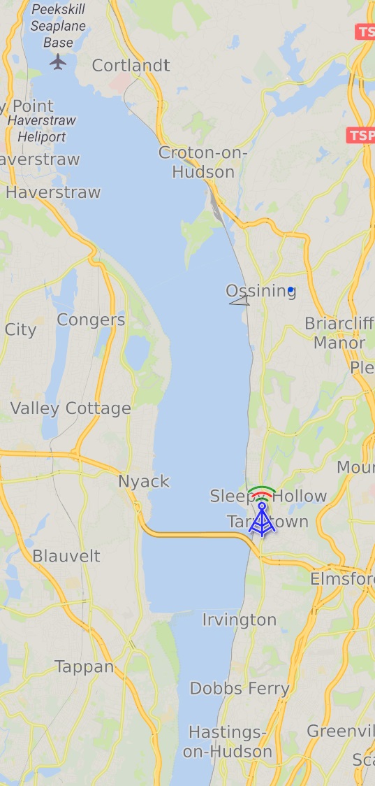
- The current maximum range of the antenna and receiver is about 13 miles north northwest to the southern tip of Verplank, NY and 6 miles south off of Hasting-on-Hudson, NY. (coverage map shown below)
- The dAISy HAT is connected to a Raspberry Pi 4 single board computer which processes the AIS signal and sends the still encoded data to another computer as well as sites such as AISHub.net and Vesselfinder.com.
- The data stream is then decoded locally by the open-source python module pyais.
- Tarrytown Transits runs a custom python program using pyais to display the live track as well as save a record of ships within range of the AIS receiver.
Plans for AIS Tracking Improvements:
- The raison d'etre for Tarrytown Ships is to learn and explore the technologies that go into curating the data and creating this site. That being said we are always looking for ways to improve the accuracy and utility of the data we provide.
-
Currently a single track is created whenever a ship is in range of the receiver. This means that the frequently changing fields such as speed, lat/lon, and heading will only be recorded as they were the last time the ship was in range of the receiver. For commercial maritime traffic this has little impact, as most if not all transits begin and end outside of our maximum range and they travel at relatively constant speed and course. For law enforcement, pleasure craft, and others it can be useful, and fun, to capture data such as max speed or tally only the vessels that cross the Tappan Zee (Mario M. Cuomo) Bridge.