
Tarrytown Transits
Maritime Data & Vision on the Lower Hudson Valley since 2024
Livestream with AIS & Computer Vision overlay
AIS station map
| Ship Name | MMSI | Ship Type | Speed | Course | Destination | Last Seen | Camera Range |
|---|
Computer Vision Project
YOLO Model Training
In a unique position to have both AIS logs and matched videos of transits, a possibility emerged to use the footage in a computer vision capacity.
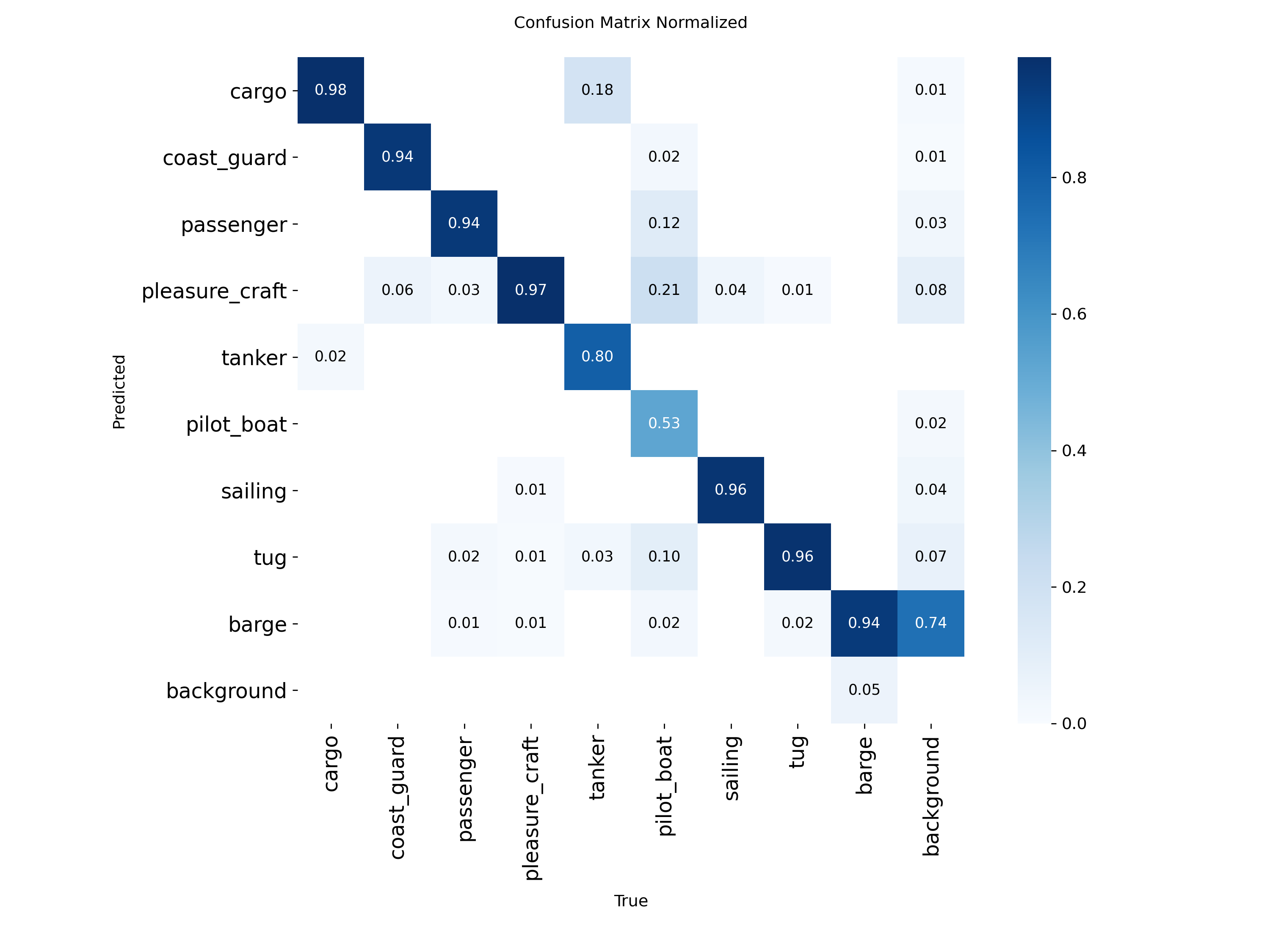
The v2 dataset includes over 71,000 video frames and 9 object classes. Annotations are derived from our 3000+ automatically recorded AIS enabled transits. Meta's SAM3.1 and Ultralytics assisted with auto-annotation. The detection model is a fine-tuned YOLO26s running via Deepstream on an NVIDIA Jetson Orin Nano 8gb.
AIS Enabled Automatic Transit Recordings
All … Clips Here
Transit dashboard
Visualized AIS data collected by the station
Historical transits
Searchable AIS transit records
| Ship Name | MMSI | Callsign | Ship Type Code | Ship Type Description | Length (LOA) | Speed | Course | Latitude | Longitude | Destination | Timestamp |
|---|